
Cowichan Lake is a vast and stunningly beautiful lake. It is the second largest freshwater lake on southern Vancouver Island, after Kennedy Lake near Tofino. Along long with Shawnigan Lake, Cowichan Lake has been one of the primary the recreation hubs for Southern Vancouver Island and is consequently a very busy lake, at least during the summer months. Development in recent years has consumed much of the shore line but with a little work it’s still possible to find lots of places to pull out for a swim, a picnic or possibly off road camping. Like so many of our island lakes, Cowichan Lake can be a windy place in the afternoon.
Latitude: 48.872877
Longitude: -124.262546
Size: 6248.6 ha | 15441 ac | 62.5 km²
 Direction: Just North of Duncan turn West onto the Cowichan Valley Highway (Hwy #18). Follow the highway for aproximately 42 km (26 mi) until you see the welcome sign for the town of Lake Cowichan. For the North shore turn right onto Youbou Road. For the South shore continue on through the town onto South Shore Rd.
Blog Posts:
External Links
- Anglers Atlas
- Backroads Map Book VIBC09 & VIBC10
- Cowichan Lake – River and Lake Access Points

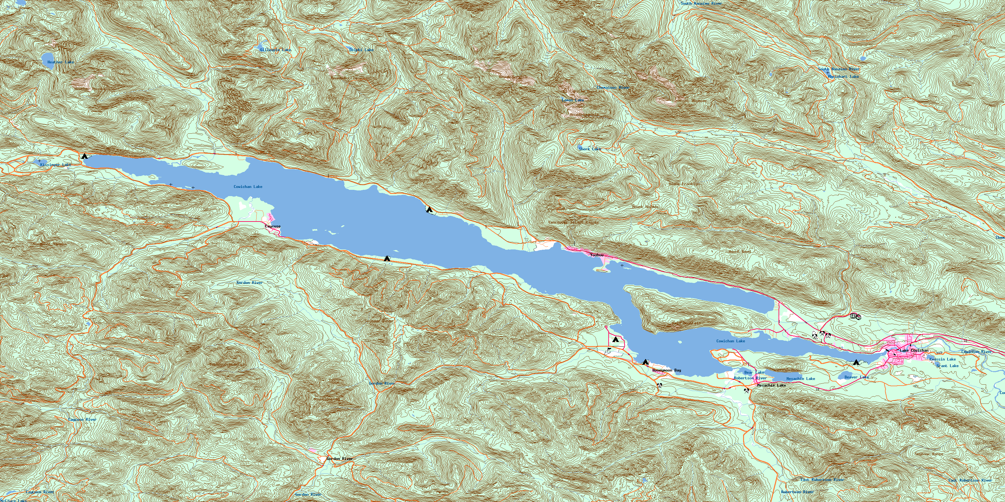
Cowichan Lake Map