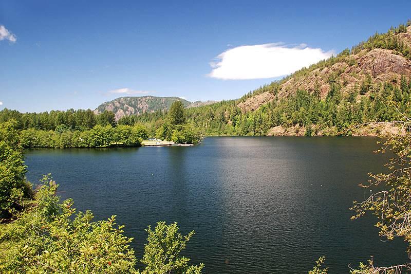
Mesachie Lake is a small but beautiful lake located just off South Shore Road, just 4-5km west of the town of Lake Cowichan. It’s probably best known for Camp Imadene which occupies most of the South-Western end of the lake. Along the North shore Mesachie Mountain rises steeply out of the lake allowing one to paddle right up against the cliff faces and rocky shore. In high water ist sometimes possible to paddle the outlet located at the North-West corner of the lake. Mesachie Lake meanes Lake of Spirits. The Cowichan First Nation believed that an old man – called the Mesachie Man in legends – lived in the lake and that anyone trespassing on his territory would be drowned in the lake’s waters.
Latitude: 48.812893
Longitude: -124.109788
Size: 58.4 ha | 144 ac | 583860 m²
Direction: Mesachie Lake is located in the Cowichan Valley, 5 km west of the village of Lake Cowichan. To get to Mesachie Lake, turn west off the Trans-Canada Highway onto Highway 18 (Cowichan Valley Highway) just north of Duncan and continue to the village of Lake Cowichan, 19 miles (31 km) west of Duncan (20 minutes). Continue on South Shore Road for 5 kilometres to Mesachie Lake. Look for Camp Imadene on the your right (North side of the road). The next turn is Forestry Road. Follow Forestry Road just past Bear Lake Road and you’ll see a dirt road (Terann Rd.) leading off to the right. I don’t believe there’s a sign of any kind. At the end of Terann Road there’s a short trail that takes you to a small gravel beach.
Blog Posts: Messachie Lake
External Links
-
Messachie Lake Map